
When planning a trip to Costa Rica, the first thing that strikes you is just how much is packed into a small space. Within just 51,100 km², you’ll find active volcanoes, primary rainforests, two ocean coastlines, Caribbean lowlands and mountains reaching over 3,800 metres. To make sense of it all, a good map of Costa Rica isn’t a luxury — it’s an essential planning tool. Here’s a complete overview of the country’s regions, cities and major sites so you can build your itinerary with confidence.
| Region | Highlights | Landscape type | Best period | Main access |
|---|---|---|---|---|
| Central Valley | San José, Poás and Irazú volcanoes, coffee | Mountains, plateaus, cloud forests | Year-round | SJO Airport (Alajuela) |
| Guanacaste | North Pacific beaches, Rincón de la Vieja, Tamarindo | Dry forest, savannah, coast | December – April | LIR Airport (Liberia) |
| Central Pacific | Manuel Antonio, Jacó, Dominical | Jungle, beaches, hills | December – April | SJO + 2.5 hrs drive |
| South Pacific / Osa | Corcovado, Drake Bay, dense jungle | Primary tropical rainforest | January – April | Domestic flight or long drive |
| Caribbean Coast | Tortuguero, Cahuita, Puerto Viejo | Humid jungle, lagoons, beaches | Sept – Oct / March – April | SJO + 3-4 hrs drive |
| Northern Lowlands | Arenal, Monteverde, La Fortuna | Volcano, cloud forest, lakes | December – April | SJO + 3-4 hrs drive |
Understanding the Map of Costa Rica at a Glance
Where Costa Rica Sits on the World Map
Costa Rica occupies the southern part of the Central American isthmus, between 8° and 11° north latitude. On a world map, it sits between Nicaragua to the north and Panama to the south. Its geographic position makes it remarkable: two distinct ocean coastlines, one on the Pacific to the west stretching over 1,000 km, and one on the Caribbean Sea to the east covering 274 km.
General Geography: Pacific, Caribbean and Central Valley
The geographic map of Costa Rica reveals a mountainous backbone running from northwest to southeast, formed by four main cordilleras. Cerro Chirripó peaks at 3,819 metres in the Talamanca Range. On either side of this spine lie coastal plains with radically different ecosystems: dry forest to the west, tropical rainforest to the east and in the south.
Map of Costa Rica’s Regions
The Central Valley and San José
This is the administrative and demographic heart of the country. The Central Valley is home to more than half of Costa Rica’s population on a plateau sitting between 900 and 1,200 metres above sea level. The climate is temperate year-round, making it the ideal logistical base for exploring the rest of the country. The Poás and Irazú volcanoes, both reachable in under two hours from San José, visually define the region.
The Guanacaste Region
Guanacaste corresponds to the country’s North Pacific. It’s Costa Rica’s driest region, with a pronounced dry season from December to April, making it the most popular beach destination for international travellers. On a tourist map of Costa Rica, you’ll find Tamarindo, Nosara, Playa Conchal and the Papagayo Gulf, along with Rincón de la Vieja National Park.
The Central Pacific Coast and Puntarenas
Between the city of Puntarenas and the mouth of the Barú River, this roughly 200 km coastal strip offers a blend of tropical forest and surf beaches. Jacó, 2.5 hours from San José, is the most accessible beach resort from the capital. Further south, Manuel Antonio National Park combines white sand beaches with forest inhabited by white-faced capuchin monkeys and sloths.
The South Pacific and Osa Peninsula
This region, the most isolated in Costa Rica on any road map, is also the wildest. The Osa Peninsula is home to Corcovado National Park, described by National Geographic as one of the most biodiverse places on Earth. Access from San José is via a domestic flight to Drake Bay or Puerto Jiménez, or a several-hour drive from Palmar Sur.
The Caribbean Coast and Limón Region
On the map of Costa Rica, the Caribbean coast forms a narrow corridor between the sea and the central cordillera. The atmosphere here is completely different from the Pacific: Afro-Caribbean culture, coconut milk cuisine, reggae music. Tortuguero, accessible only by boat or plane, is the most important green sea turtle nesting site in Central America. Cahuita and Puerto Viejo attract travellers looking for authentic experiences.
The Northern Lowlands
The Northern Lowlands spread out at the foot of the Tilarán and Central cordilleras, towards the Nicaraguan border. This is where two of Costa Rica’s most iconic destinations lie: La Fortuna and Arenal Volcano, as well as Monteverde and its cloud forest. Journey times from San José range between 3 and 4 hours depending on the route chosen.
Map of Costa Rica’s Main Cities
San José, Capital and Heart of the Country
San José doesn’t look like a picture-postcard capital. It’s dense, lively, sometimes chaotic, but it holds some surprisingly good museums: the Museo del Oro Precolombino, the Museo del Jade and the Teatro Nacional, an architectural gem from the 19th century, each worth half a day. The city’s markets, like the Mercado Central, offer a genuine glimpse into everyday Costa Rican life.
Alajuela, Cartago and Heredia
These three cities, along with San José, form the Greater Metropolitan Area visible on any detailed map of Costa Rica. Alajuela is the city closest to Juan Santamaría International Airport, just minutes from the airport area. Cartago, the former colonial capital, is home to the Basilica of Nuestra Señora de los Ángeles, a major pilgrimage site for Costa Ricans.
Puntarenas and Limón
Puntarenas is the main port on the Pacific coast and the departure point for ferries to the Nicoya Peninsula. It’s also an authentic, largely untouristed city overlooking a calm gulf. Limón, on the Caribbean coast, is the largest city in the region and the main eastern port. Located 4 km south of the centre, Limón domestic airport makes Tortuguero and Cahuita easier to reach.
Tourist Map of Costa Rica: Must-See Places
Major Volcanoes and National Parks
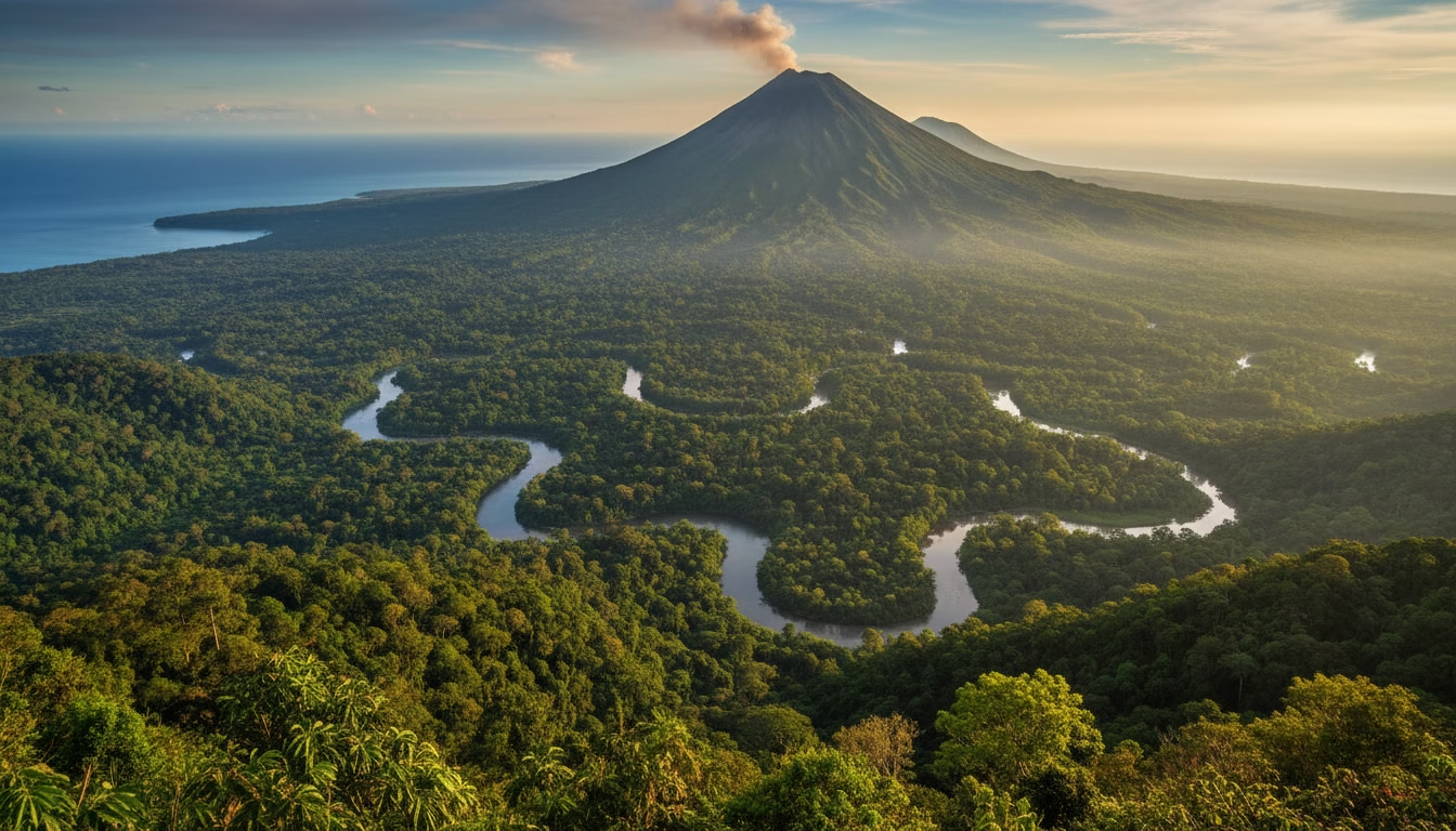
Costa Rica’s volcanic map counts over 200 cones, six of which are considered active. Arenal Volcano, in the Northern Lowlands, is the most photogenic. Poás, easily reachable from San José, offers a crater accessible by car up to the viewpoint. Turrialba, intermittently active, dominates the eastern central valley. Rincón de la Vieja in Guanacaste combines hiking with hydrothermal springs.
The Most Beautiful Pacific and Caribbean Beaches
On a beach map of Costa Rica, the contrast between the two coastlines is striking. On the Pacific side, Tamarindo, Samara, Santa Teresa and Playa Conchal are the most visited. On the Caribbean side, Cahuita, Manzanillo and Playa Cocles offer a very different atmosphere, with warmer waters and vegetation that reaches right down to the sand. The Nicoya Peninsula concentrates some of the country’s most varied beaches.
Nature Reserves and Biodiversity Zones
Around 25% of Costa Rica’s territory is protected in various forms: 30 national parks, 19 wildlife refuges and 8 biological reserves. Corcovado, Manuel Antonio, Tortuguero and Monteverde are among the most visited. The Bosque Nuboso de Monteverde reserve, perched at 1,440 metres altitude, protects one of the most accessible and remarkable cloud forests in Central America.
Useful Maps for Organising a Trip to Costa Rica
Map of Airports and Entry Points
Costa Rica has two international airports. Juan Santamaría Airport (SJO), located in Alajuela about 20 km from San José, is the country’s main entry point. It serves the Caribbean, Central Pacific, south and Northern Lowlands. Daniel Oduber Quirós Airport (LIR) in Liberia is the ideal gateway for Guanacaste. The two airports are 210 km apart, roughly a 3-hour drive.
Map of Routes and Distances Between Destinations
Costa Rica’s road map can be misleading: distances look short, but travel times are often long. From San José to La Fortuna, allow 3 hours. From San José to Manuel Antonio, about 2.5 hours. From San José to Puerto Viejo de Talamanca, at least 4 hours. Secondary roads, often unpaved during the wet season, add considerably to journey times.
Map of Climate Zones and Weather
Costa Rica’s climate map shows two distinct seasons: the dry season from December to April and the wet season from May to November. The North Pacific receives less rainfall than the rest of the country. The Caribbean has an inverse rainfall pattern, with dry windows in September-October and March. The Central Valley enjoys a near-permanent spring, with temperatures between 18 and 25°C.
How to Use a Map to Plan Your Costa Rica Itinerary
Building a Road Trip Between Volcanoes, Jungle and Beaches
A well-planned Costa Rica itinerary follows geographic logic: it avoids unnecessary backtracking by relying on a detailed road map of the country. A classic two-week road trip departs from San José, heads up to Arenal and Monteverde, drops down to the Central Pacific, then loops up to Guanacaste before returning via Liberia. This circuit covers the main regions without retracing the same road twice.
Choosing Regions Based on the Length of Your Stay
For a 7-day trip, focus on a single region, such as the Northern Lowlands with Arenal and Monteverde, or the Central Pacific with Manuel Antonio. For 10 to 12 days, combine two complementary regions. From 14 days onwards, it becomes feasible to include the Caribbean coast or the Osa Peninsula without feeling constantly in transit between stops.
Interactive Map of Costa Rica: Creating Your Personalised Itinerary
Finding Activities: Volcanoes, Beaches, Hikes and Villages
Interactive maps like Google Maps or Maps.me let you visualise actual distances between stages of your trip at a glance. I always recommend downloading the offline map before you leave, as connectivity can be unreliable in rural areas. These tools allow you to filter by activity type: hiking, beach, wildlife. Google Maps now includes national park entrances and the most well-known lodges.
Saving Favourite Places to Organise Your Trip
Creating a list of saved places on Google Maps before heading to Costa Rica is a habit I consistently recommend. You can save accommodation, park entrances, restaurants and viewpoints. It saves you from searching for an address with an unstable connection on the ground. The Maps.me app works entirely offline and is well suited to remote areas like Osa or Tortuguero.
FAQ on the Map of Costa Rica
Where is Costa Rica on the World Map?
Costa Rica is located in Central America, between Nicaragua to the north and Panama to the south. It borders the Pacific Ocean to the west and the Caribbean Sea to the east. On a world map, it appears in the lower part of the Central American isthmus, at around 10° north latitude, between North and South America.
What Are the Main Tourist Regions of Costa Rica?
The country divides into six major tourist zones: the Central Valley around San José, Guanacaste on the North Pacific, the Central Pacific with Manuel Antonio and Jacó, the South Pacific and Osa Peninsula, the Caribbean coast with Tortuguero and Puerto Viejo, and the Northern Lowlands with Arenal and Monteverde. Each region has its own distinct identity.
What Map Should I Use to Plan a Road Trip in Costa Rica?
For road trip planning, the detailed 1:250,000 Costa Rica road map published by IGN or the Travel Map from Costaricaguide.com are widely recommended. Digitally, Google Maps and Maps.me cover the road network well. Also look for maps from the ICT, the Costa Rican Tourism Institute, available free of charge at tourist offices and some car rental agencies.
What is the Best Area of Costa Rica to Visit?
There’s no universal answer to that question. It all depends on your priorities: if sun-guaranteed beach time is what you’re after, Guanacaste between December and April is your best bet. For biodiversity and primary forest hiking, the Osa Peninsula is unmatched. For a first well-rounded trip balancing volcanoes, nature and sea, the Northern Lowlands combined with the Central Pacific offers the best ratio of diversity to accessibility.